Latest News


Met office issues severe weather alert for Jamaica
October 04, 2020
The Meteorological Service has issued a severe weather alert for the island.
The measure remains in effect until 5 p.m. on Monday.
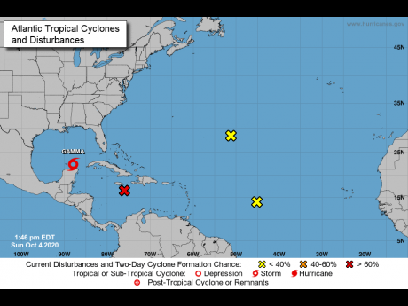
The met office says an area of low pressure associated with a strong tropical wave currently located about 230 km southeast of Jamaica is expected to move into the vicinity of the island by this evening.
Satellite imagery indicates that the system has a large area of showers and thunderstorms extending across the central Caribbean.
Additionally, the associated shower and thunderstorm activity is beginning to show some signs of organisation and there is a 70% chance that the system could become a tropical depression within the next 24 to 48 hours.
As the system moves west -northwestward, projections are for cloudy conditions with periods of showers and thunderstorms, which may be heavy at times, along with strong gusty winds to affect sections of most parishes beginning tonight and continuing through to Tuesday evening.
Sea conditions will deteriorate in the vicinity of showers, thunderstorms, and strong gusty winds.
Marine interest, especially those on the south coast, should exercise extreme caution until conditions improve.
The met office says it will continue to monitor this situation.
We want to hear from you! Email us at star@gleanerjm.com and follow @thejamaicastar on Instagram and on twitter @JamaicaStar, and on Facebook: @TheJamaicaStar.


